Zhangjiajie’s Sandstone Pillars and the Geology Behind Them

The cliff faces of Zhangjiajie’s sandstone pillars in Hunan Province, China, hold their green through every season.
Ancient trees have rooted into fissures in the sandstone, their trunks pressed against the stone and their branches reaching over gorges that drop hundreds of metres into the subtropical forest below. The rock behind them reveals its layering in horizontal bands of amber and pale quartz, the compressed record of approximately 380 million years of sediment. Streams run between the pillar bases. The air carries the smell of wet rock and old forest together.
The Zhangjiajie sandstone pillars look different up close from anything captured in a photograph. Quartz in the rock surface catches the light in a way that limestone does not: brighter and more direct, as if the stone were lit from within. The pillar faces appear alive. In a geological sense, they are. Roots growing into the fissures widen existing fractures, while water, ice and erosion continue to weaken the rock. Material is still falling. The gorges are still deepening.
The pillars remain standing because their quartz-rich sandstone is more resistant than much of the rock and sediment that once surrounded them. The gorges between the pillars are where that softer material used to be.
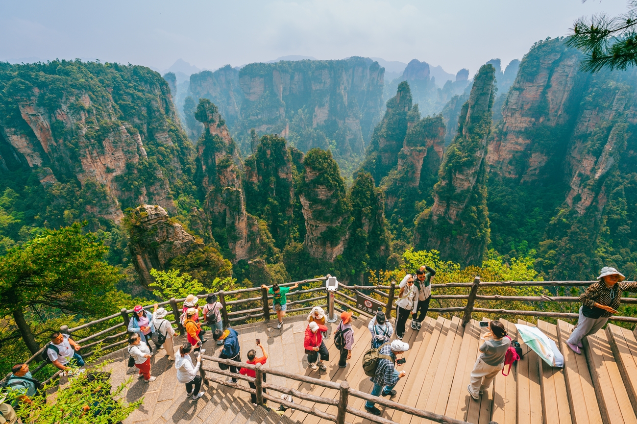
The 380-Million-Year Sequence
The story of Zhangjiajie's sandstone pillars began long before the first forests appeared, long before the first mountains rose, and long before any human being looked upon the landscape. What visitors see today is the result of hundreds of millions of years of geological change, each stage building upon the last.
An Ancient Sea
Around 380 million years ago, Zhangjiajie lay beneath an ancient sea. Over time, tectonic forces lifted the former seabed above sea level, transforming the area and leaving behind a 500-metre-thick layer of quartzite sandstone.
During the Middle Devonian period, the shallow sea that covered northwestern Hunan collected vast quantities of sand and silt from the surrounding highlands. Rivers carried this material into the basin over tens of millions of years. The sediment settled in layers, each one compressing those below, until loose sand gradually became stone.
The high quartz content of the rock, over 75 percent in the densest beds, is the detail that determined everything that followed. Quartz is harder and more resistant than the calcium carbonate that forms limestone. When exposed to hundreds of millions of years of erosion, that difference in resistance became the difference between what disappeared and what remained standing.
As the sediment compacted under the weight of the layers above it, it cemented into the quartz-rich sandstone that now forms the pillar walls. The horizontal bands still visible in the pillar faces are the record of those ancient deposits, each layer marking a phase of sediment settling onto the seabed before being compressed into stone.
The walls of the pillars are reading their own geological autobiography.
The wider story of how these formations fit into Zhangjiajie's floating forests landscape is explored in our guide to Zhangjiajie and the Floating Forests: China's Most Surreal Landscape, in Context.
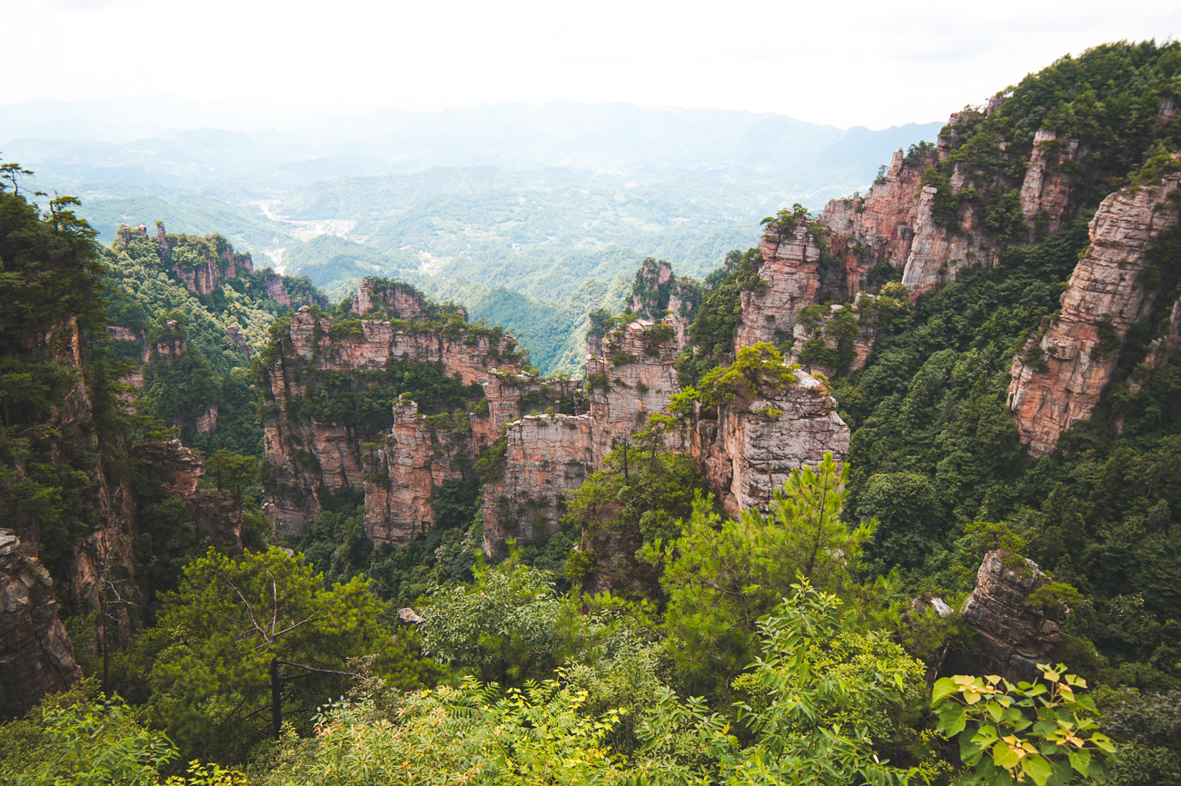
The Tectonic Uplift
The events that turned a seabed into the highest point in Hunan Province began approximately 200 million years ago.
Powerful forces within the Earth's crust dramatically altered the region. The originally flat-lying sandstone beds were uplifted, tilted and subjected to immense pressure. This tectonic activity also created a dense network of vertical cracks and fractures within the sandstone, known as joints.
The joint network is the structural key to the landscape. Joints are natural planes of weakness within the rock, created by the stress of the uplift rather than by external erosion. They run in specific orientations, determined by the direction and intensity of the tectonic forces.
These directional families of joints created a three-dimensional fracture grid within the sandstone mass. That grid, invisible while the rock was still a continuous plateau, became the template for every gorge, every pillar profile and every cliff face visible in the park today.
The Erosion
Phase
With the joint network established and the land lifted above sea level, the erosion that would define the landscape began.
Rain entered the joints and widened them by carrying away loosened particles. Frost expanded within the cracks during colder periods, then contracted as temperatures rose, progressively prying the joints wider. Vegetation colonised the joint surfaces, with roots driving deeper into the stone and contributing pressure over decades and centuries. Gravity removed loosened rock from the pillar walls and carried it into the valleys below.
As material was carried away by rain, streams and gravity, the more resistant cores were gradually isolated. This differential erosion removed the weaker surrounding rock, leaving behind the vertical, straight-edged pillars that define Zhangjiajie today.
Where the joints were closely spaced, the rock between them eroded completely. Where the sandstone was more massive and less fractured, it resisted and remained. The gorges follow the densest joint sets. The pillars occupy the zones of greatest resistance.
The landscape is a three-dimensional map of the original fracture network, made visible by removal.
The
Zhangjiajie Landform: A Geological Category of One
In 2010, the quartz-sandstone peak forest landscape of Wulingyuan was formally recognised as the Zhangjiajie Landform. The designation gave a name to what the UNESCO World Heritage inscription of 1992 had already made clear: this is not simply an impressive mountain landscape, but a geological formation of exceptional rarity.
Its uniqueness comes from the precise combination of three conditions. First, a thick layer of highly pure quartz-sandstone. Second, intense tectonic fracturing that created a dense and regular joint network. Third, prolonged erosion under a moist climate, working slowly through those fractures over immense spans of time.
Individually, those conditions are not unique. Quartz-sandstone exists elsewhere. Tectonic joint systems occur across many mountain regions. Humid climates shape landscapes throughout eastern Asia. What makes Zhangjiajie different is the coincidence of all three at sufficient scale: a sandstone layer hundreds of metres thick, a joint system dense enough to divide the plateau, and erosion persistent enough to produce more than 3,000 isolated towers across Wulingyuan.
This is why Zhangjiajie feels less like a conventional mountain range and more like a forest of stone. More than 3,000 sandstone pillars rise through the park, with many reaching extraordinary heights. The concentration, purity and scale of the formations are what make the landscape globally distinctive.
The process is not finished. Geologists classify the park as being in the youthful stage of its peak forest evolution. The crust continues to rise slowly, joints continue to widen, and erosion continues to shape the pillars and gorges. The landscape visitors see today is not a completed monument. It is a moment in an unfinished geological process.

Why
the Pillars Look Like They Float
The cloud sea at Yuanjiajie is not just atmospheric. It is meteorological, and it is directly connected to the geology of the park.
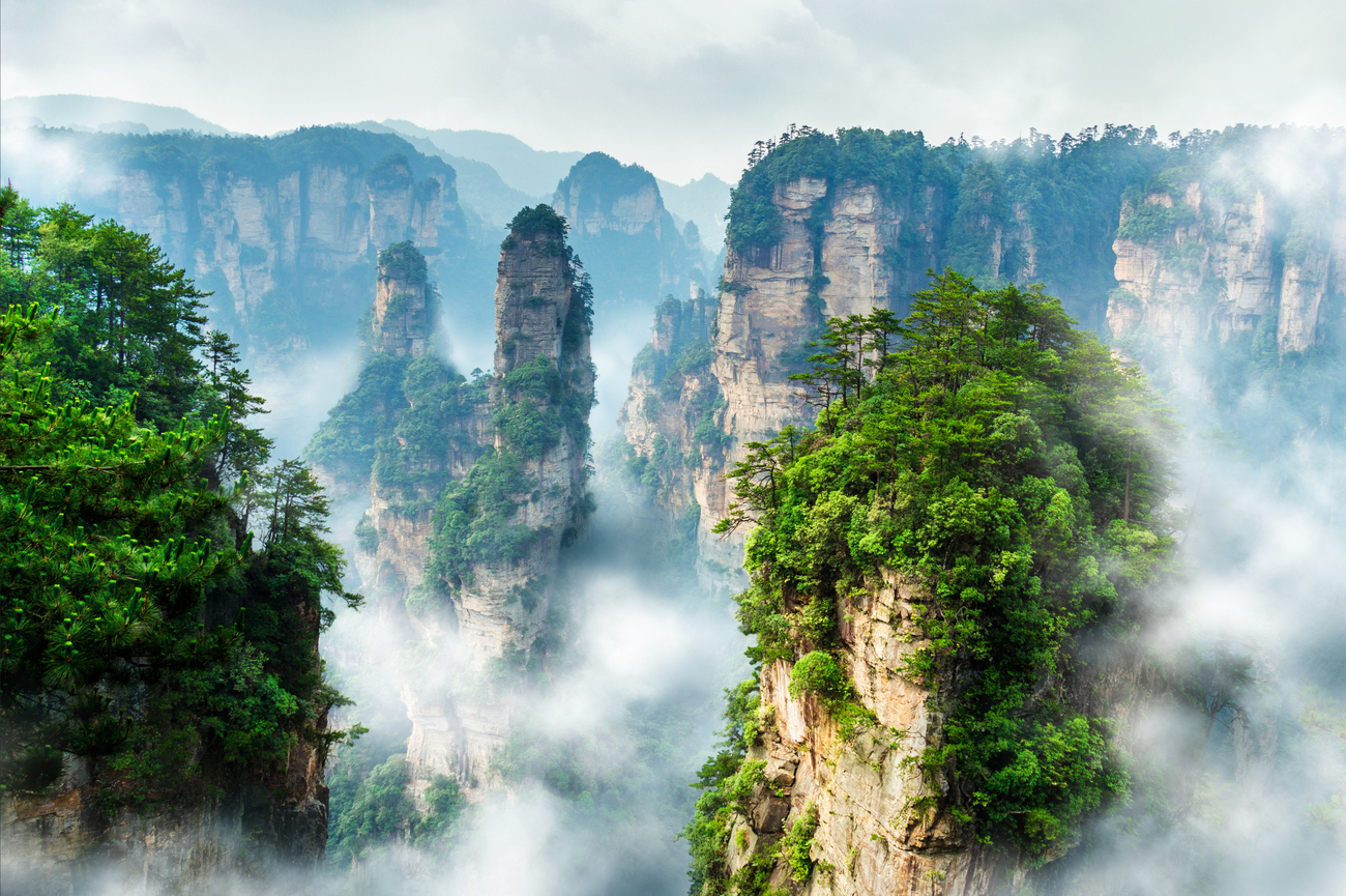
The gorges between Zhangjiajie's sandstone pillars are deep, narrow and shaped by the same joint systems that created the formations themselves. Warm, moisture-laden air gathers at valley level. When cooler air settles above it, the moisture condenses into fog inside the gorges while the plateau and pillar tops remain in clearer air.
The result is the floating effect for which Zhangjiajie is famous. The fog fills the deep channels between the pillars, hiding the valley floor and leaving the stone towers rising above a white sea. Because many of the gorges are hundreds of metres deep but comparatively narrow, the cloud is concentrated and held in place by the surrounding walls. This is what makes the cloud sea at Yuanjiajie so dramatic compared with mist in broader mountain valleys.
This same atmospheric condition helped inspire the floating mountains of Avatar. The film's production team recognised that a layer of cloud between the ground and the stone towers made the landscape appear suspended in air. At Yuanjiajie, that illusion is not invented. It is created by the relationship between sandstone, fracture, gorge depth and morning weather.
The full story of how Zhangjiajie influenced Avatar, and what the real landscape offers beyond the film association, is explored in our dedicated guide to Avatar and Zhangjiajie.

The
Distinction From Karst
The Zhangjiajie sandstone pillars are often described in travel coverage as karst formations. They are not. The distinction matters because it explains why this landscape feels so different from the limestone scenery of Guilin's Li River valley or Vietnam's Ha Long Bay.
Karst landscapes form through chemical dissolution. Slightly acidic rainwater slowly dissolves limestone, removing calcium carbonate over millions of years and producing rounded peaks, caves and smooth-sided forms.
Zhangjiajie formed differently. Its pillars are quartz-rich sandstone, shaped by physical erosion rather than chemical dissolution. Rain, ice, roots and gravity worked along vertical fracture joints, breaking the rock apart mechanically and removing it piece by piece.
The visual result is completely different. Karst landscapes tend towards rounded, conical forms. Zhangjiajie's sandstone peak forest produces vertical faces, angular profiles and straight-edged towers. The pillars look less like eroded cones and more like standing slabs of stone, which is exactly what they are: the sections of rock that resisted erosion best.
This distinction is also why Tianmen Mountain feels so separate from Zhangjiajie National Forest Park. Tianmen Mountain, 8 kilometres south of the park, contains a cave formed by karst processes in limestone. The national forest park is a quartz-sandstone landscape shaped by fracture and resistance. The two places share a city, but geologically they belong to different stories.
The contrast between these two landscapes is explored further in our dedicated guide to Tianmen Mountain and the Glass Walkway.

The
Pillar Profiles and What They Record
Not all of Zhangjiajie's sandstone pillars are the same height, and that variation is not random. Each profile records a different stage in the erosion process.
The highest formations, including plateau remnants such as Yuanjiajie, are sections of the original sandstone mass where the joint network was less dense and the rock resisted erosion more successfully. Lower down, where fractures were more closely spaced and erosion advanced further, the landscape breaks into peak walls, clusters, individual pillars and smaller remnant rocks near the valley floor.
Yuanjiajie itself is not a mountaintop in the conventional sense. It is a preserved section of the original upper sandstone surface, left standing because the rock beneath it was strong enough and sparsely fractured enough to survive what removed the surrounding material.
Walking across the plateau is therefore not simply walking above the landscape. It is walking across a remnant of an ancient seabed, raised hundreds of metres above the valleys and preserved through an extraordinary sequence of geological resistance.
The individual pillars at different elevations reveal how far that process has advanced in different places. A taller pillar usually marks a section of rock where wider joint spacing preserved a larger mass. A lower pillar often marks an area where fractures were closer together and erosion progressed further.
The height, shape and position of each formation are therefore part of the geological record. Zhangjiajie's pillars are not just spectacular vertical forms. They are measurements of resistance, time and removal written into the landscape.
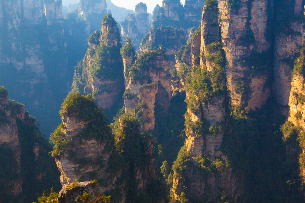
The Biodiversity the Geology Protects
The sandstone peak forest of Wulingyuan did more than create a spectacular landscape. It also helped protect the life within it.
For centuries, the gorges between the pillars were difficult to reach. Cliff faces were too steep to cultivate, valley floors were enclosed by rock, and plateau tops could only be accessed by demanding trails. This natural inaccessibility limited farming, settlement and large-scale disturbance, allowing subtropical forest ecosystems to survive in places where more accessible landscapes were gradually altered.
Today, Wulingyuan is home to thousands of plant species, including ancient and rare trees that thrive in the sheltered gorge environments created by the pillar landscape. These microclimates, shaded, humid and protected, preserve a living layer of the park's natural history alongside its geological one.
The wildlife is equally important. The park's streams and forests support species such as the Chinese giant salamander, while its more remote slopes and cliffs provide habitat for animals adapted to steep, difficult terrain.
The forest covering Zhangjiajie's pillars is not simply decoration. It is part of the landscape's ongoing evolution. Roots enter fractures, widen cracks and help continue the same slow process of erosion that shaped the gorges and towers in the first place.
In Wulingyuan, geology protects biodiversity, and biodiversity continues to shape the geology.
The Cloud Sea, the Light, and the Best Time to Be Here
Zhangjiajie National Forest Park rewards timing more than most landscapes.
The cloud sea forms most reliably in the early morning, especially between October and April after rain. At this time, the temperature difference between the gorge floor and the plateau above is at its strongest. Moist air settles in the valleys, condenses into fog, and remains trapped between the sandstone pillars while the upper formations rise into clearer light.
The best window is usually within the first two hours after the park opens. By mid-morning, the air warms, the inversion begins to break, and the cloud sea often starts to dissolve, revealing the gorges below the viewpoints.
October is especially rewarding. Post-rain cloud formation, cooler morning temperatures and clearer afternoon air often combine with a warmer quality of light on the sandstone. The quartz-rich faces catch the lower autumn sun differently, giving the pillars an amber tone that summer haze rarely produces.
At Yuanjiajie, the Bailong Elevator adds another layer to the experience. Entering the glass cabin early in the morning during a cloud sea event means rising through white mist before emerging above it, with pillar tops visible in every direction and the gorges hidden below. In 88 seconds, the elevator compresses the transition from valley floor to plateau into one extraordinary ascent.
Seeing Zhangjiajie well is not only about choosing the destination. It is about knowing which entrance to use, when to arrive and which conditions are worth waiting for. The landscape changes by the hour, and the best version of it belongs to those who reach the right viewpoint at the right moment. Our China Floating Forests itinerary is designed around those decisions.

The Morning the Gorges Disappear
The fog settles before the sun arrives. It fills the deep channels between the pillars, and the towers rise above the white into clear sky, each one separate, each one lit amber by the first light. The gorges beneath them vanish. The streams, the valley floor, the hundreds of metres of depth, all of it is replaced by cloud.
Standing on the Yuanjiajie plateau above the cloud sea is the experience this entire geology story has been building towards. The rock created the fracture network. The fracture network created the gorges. The gorges trapped the fog. The fog created the floating landscape that travellers cross the world to see.
Science makes Zhangjiajie more interesting. It does not make it less beautiful.
October mornings at Yuanjiajie are when the cloud sea often holds longest and the light on the sandstone is at its warmest. Our China Floating Forests itinerary is designed around the timing, access and sequencing needed to experience this landscape at its best.


Let us know what you love, where you want to go, and we’ll design a one-of-a-kind adventure you’ll never forget.
Get in touch
Miriam
Travel Specialist

Nina
Travel Specialist

Abigail
Travel Specialist
Our offices:



Revigorate, Iberian Escapes and Algarve Lifestyle are the registered brand names of APCS Lda . We are a fully authorised travel agency licensed by Turismo de Portugal RNAVT/6867.
In the event of a dispute, the consumer may refer to: RAL - Centros de Arbitragem
Avª. 5 de Outubro, nº. 55, R/C Dtº. 8000-075 Faro, Portugal | Tel: +351 289 823 135 *
* national landline call
E-mail: info@consumoalgarve.pt| www.consumidoronline.pt | Mon to Fri: 9:00 - 13:00 / 14:00 - 17:00