How to Visit Praia das Catedrais, and Why Ribadeo and Ferrol Are Galicia's Finest Coastal Stops
Praia das Catedrais is one of Galicia’s most extraordinary coastal landscapes, but visiting it depends entirely on the tide. The famous rock arches and sea caves can only be explored safely at low tide, and access may also require advance registration during the busiest periods. Ribadeo and Ferrol make natural companions to the beach, combining historic ports, Atlantic scenery and some of the most rewarding stops on Galicia’s northern coast.
Twice a day, the sea walks back into Praia das Catedrais and the beach disappears. The arches everyone comes to see, the tallest rising close to thirty metres, stand in the water with waves running through them, while the sand lies several metres below the surface. Then the tide turns and slowly gives it all back.
That is the first thing to understand about how to visit Praia das Catedrais, the Beach of the Cathedrals, on the Galician coast just outside Ribadeo. The beach keeps its own hours, and they are rarely the ones you would have chosen.
This is one of the most photographed stretches of shoreline in Galicia and the third chapter of our Exploring Northern Spain by Narrow-Gauge Railway journey. The line crosses west from Asturias, following the coast from Oviedo and Ribadesella before continuing towards Ribadeo and Ferrol.
Visiting Praia das Catedrais successfully comes down to two things: arriving at the right point in the tide and having any required access arrangements in place. Both can be organised before you travel, which is the advantage of experiencing this coast as part of a carefully planned railway journey.
What follows is what waits when the water retreats.
A
Beach the Sea Takes Back Twice a Day
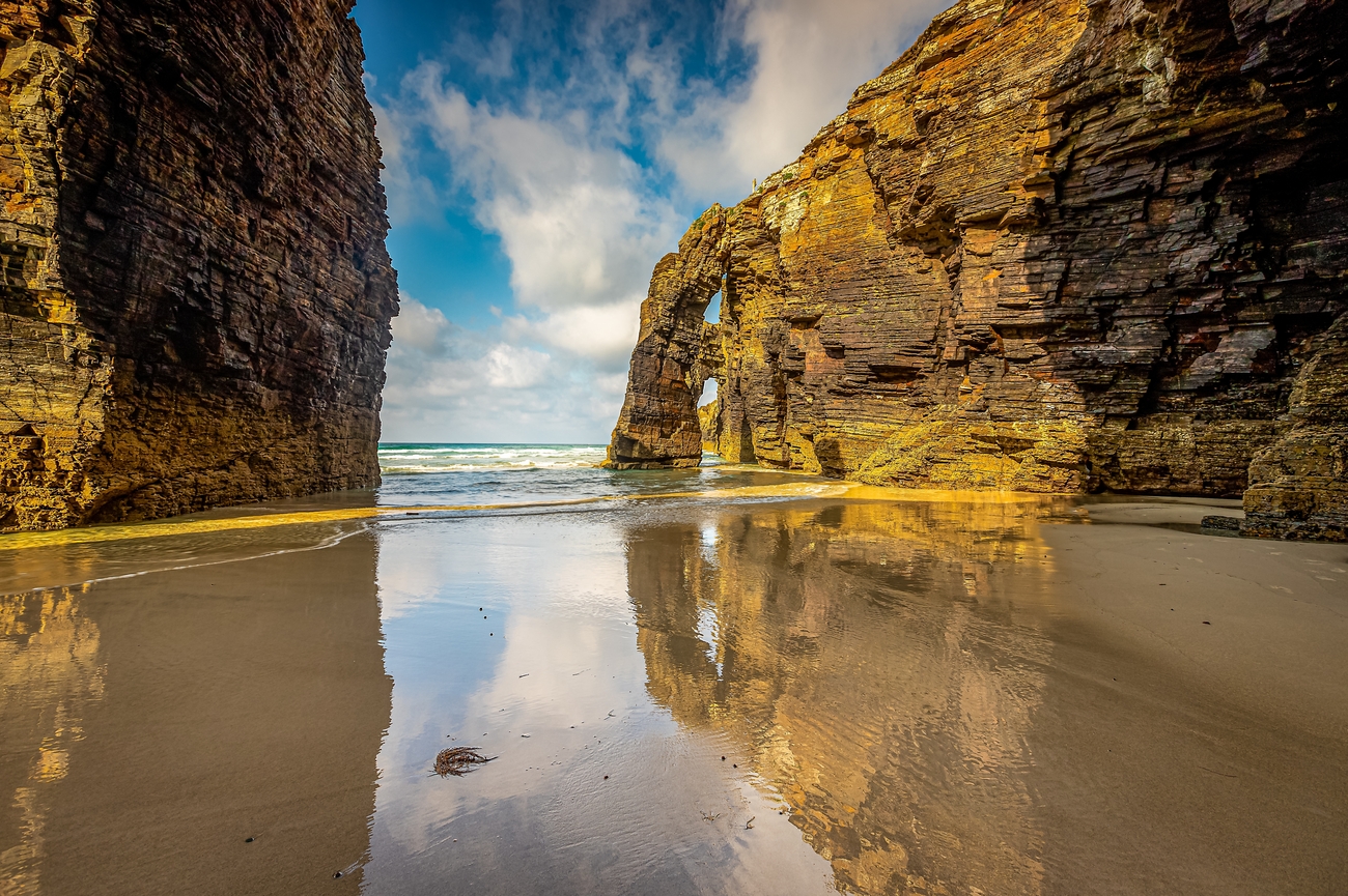
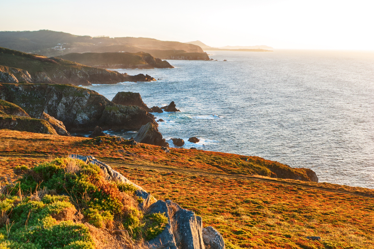
Praia das Catedrais is shaped by the constant movement of the Atlantic. At low tide, the sea reveals a landscape of vast stone arches, narrow passages, caves and isolated coves. At high tide, much of it disappears beneath the water, leaving only the cliffs and the tops of the formations visible from above.
The rock here is slate and schist, layered almost vertically, and the Atlantic has spent thousands of years breaking it apart. What remains at low tide is a succession of arches, sea caves and long, roofless corridors of stone that came to be compared with the architecture of a cathedral.
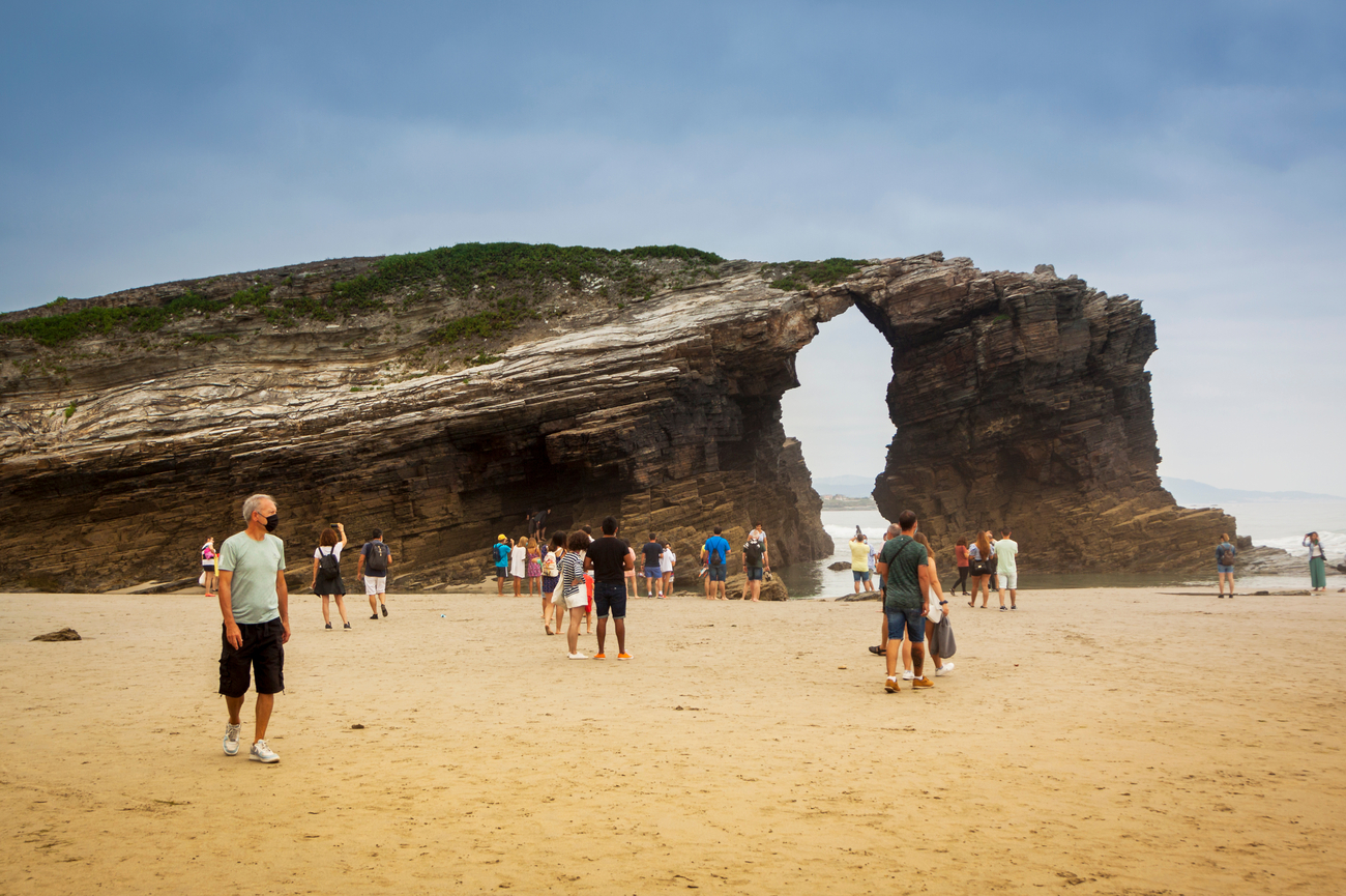
There is a great triple arch that visitors can walk beneath and immense natural buttresses rising from the sand. Between the largest formations, the retreating water opens smaller coves and passages that may remain accessible for only an hour or two before the sea begins to reclaim them.
You approach along a wooden walkway above the cliffs and descend to the beach by a stone staircase. From the clifftop at high tide, it is difficult to imagine the landscape concealed below. The upper path provides viewpoints over the shore, but when the water is in, the arches appear half-drowned and the sand beneath them is entirely inaccessible.
At the right stage of the tide, however, you can walk across the beach and beneath the formations themselves. The stone rises almost thirty metres overhead, while the sound of the sea is caught and softened inside the caves and arches. Visitors often begin speaking more quietly without consciously deciding to do so. The comparison with a cathedral suddenly feels entirely natural.
Praia das Catedrais has been protected as a Natural Monument since 2005 and forms part of a longer stretch of distinctive coastline between Ribadeo and Foz. It is not a conventional beach where you come to spend the afternoon. There are no rows of sun loungers or beach clubs, and the sand itself is only temporarily available.
The experience lies in walking through the formations while the tide allows it, craning your neck beneath the arches and watching the sea begin to return through the passages behind you. Arrive near the lowest point of the tide and this becomes one of the strangest and most memorable hours on Spain's northern coast.
Beyond
Praia das Catedrais
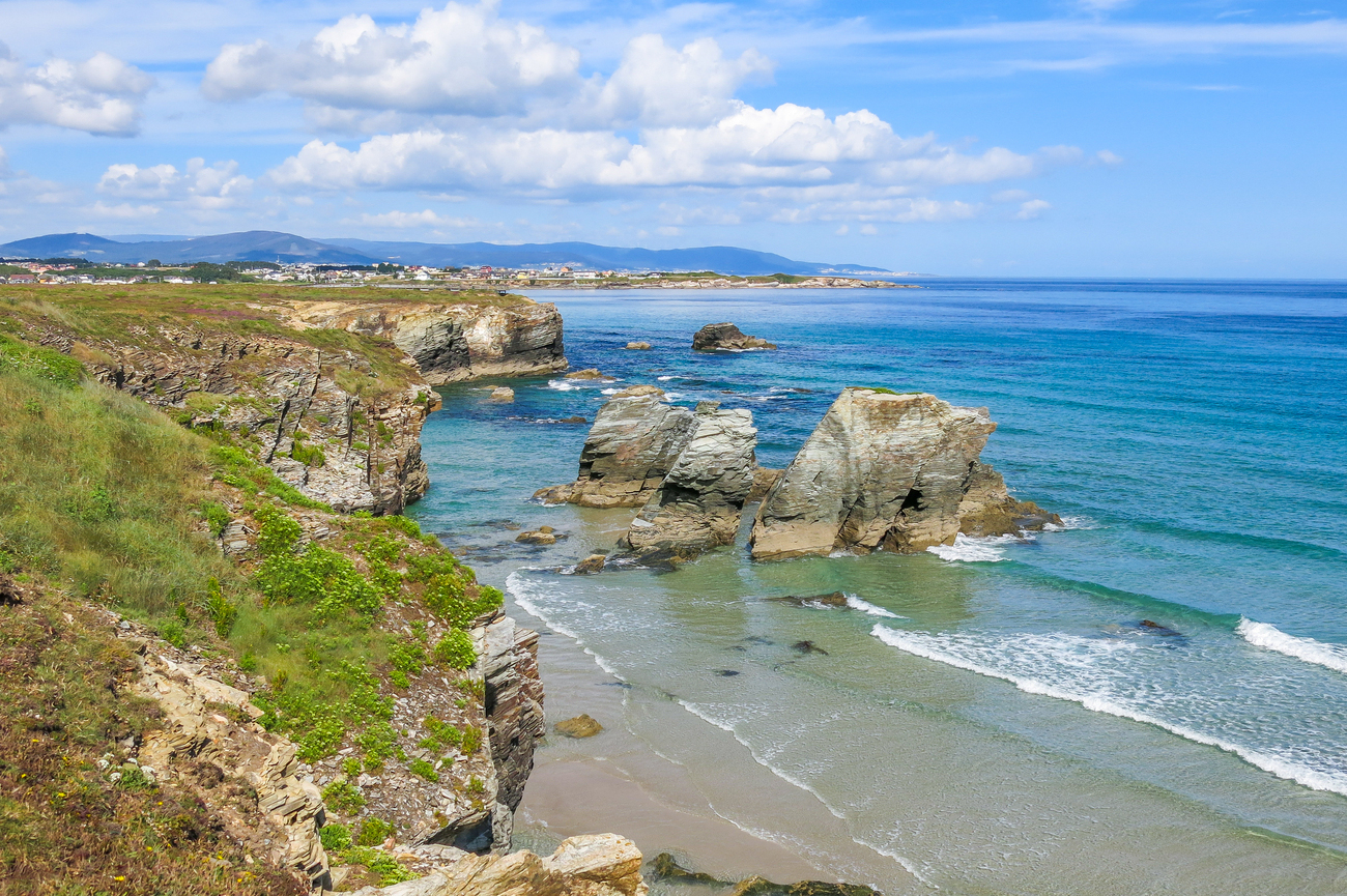
The arches are the headline, but the protected shore extends for miles in both directions, and there is much more here than a single famous beach.
To the east, towards the fishing village of Rinlo, Praia dos Castros has its own sea stacks, arches and hidden coves, usually with fewer visitors. The coastline between the two beaches can be followed along clifftop paths, revealing smaller formations that receive far less attention.
Farther west, around Foz, summer boat trips sometimes follow the base of the cliffs, showing the coastline from the water and offering an angle impossible to appreciate from the upper paths.
The Camino Natural de la Ruta del Cantábrico also passes above this shoreline, tracing the coast through beaches, headlands and small fishing settlements. For walkers continuing west, the route eventually connects with the wider network of coastal paths leading towards Ferrol, the final major stop on this narrow-gauge railway journey.
How to Visit Praia das Catedrais: The Permit and the Tide
Visiting Praia das Catedrais successfully depends on two things: the tide and, during the busiest parts of the year, a free access permit. The beach and its great arches can only be explored when the sea has retreated far enough, so the visit must be planned around low water rather than fitted into an otherwise convenient hour.
The tide comes first. At high water, the sand, caves and passages beneath the cliffs are inaccessible, leaving visitors on the clifftop path looking down at a landscape largely covered by the sea. The useful walking period falls around low tide, but its precise length varies with the height of the tide, sea conditions and the area you hope to explore. Checking the official tide information before setting out is therefore essential. Galicia’s tourism authority is unequivocal: walking on the sand is only possible at low tide.
This is why the low tide at Praia das Catedrais matters more than the time of day you would ordinarily choose to visit. A bright afternoon is of little use if the arches are underwater. The beach keeps its own timetable, and the rest of the day has to be arranged around it.
The second consideration is the permit. Access to the beach is regulated during Holy Week and from 1 July to 30 September. During these periods, visitors need a free authorisation issued through the Xunta de Galicia’s official reservation system. The current conservation plan sets a maximum of 4,812 people per day, although access arrangements and exceptional restrictions can be adjusted when required for conservation or public safety.
Outside the regulated dates, advance authorisation is not normally required, but the tide still governs whether the beach itself can be entered. The clifftop paths and viewpoints remain available when the sand is inaccessible, although they cannot replace the experience of walking beneath the arches.
This is where staying in Ribadeo and planning the coast as an arranged journey changes the experience. The visit can be organised around the correct tide, with any required authorisation secured in advance and the transfer timed for when the sea has withdrawn. You are not brought to Praia das Catedrais simply because it fits neatly between breakfast and lunch. The day is built around the short period in which the beach reveals itself.
That is the difference between seeing Praia das Catedrais properly and arriving to find the arches standing in the water below. Our Exploring Northern Spain by Narrow-Gauge Railway itinerary is designed around the tide, so that when you reach the coast, the sea has already made way.
Ribadeo at the Mouth of the Eo
Ribadeo stands where the River Eo meets the Cantabrian Sea, forming the natural boundary between Galicia and Asturias. Known for its elegant Indiano architecture, historic port and estuary landscapes, it is the ideal base for visiting Praia das Catedrais while offering plenty to discover in its own right.
The town prospered during the nineteenth and early twentieth centuries, and its wealth remains written into the streets. Thousands of Galicians left for Cuba, Argentina and Mexico, made successful lives overseas and eventually returned home as indianos, building grand residences that reflected both their fortunes and the architectural influences they had brought back across the Atlantic.
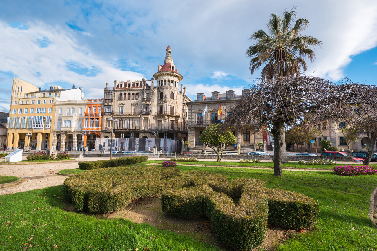
The finest of them is the Torre de los Moreno, dominating Praza de España since 1915. Designed in an exuberant Modernist style, its decorative façades, glazed galleries, ornate balconies and distinctive domed corner tower have made it the architectural symbol of Ribadeo. Around it stand more Indiano houses, painted in soft colours and lined with enclosed galleries, together creating one of the finest collections of returnee architecture in Galicia.
The River Eo itself defines the town. Cross the long bridge leaving Ribadeo and, within minutes, you are back in Asturias, the region you travelled through only hours earlier. The broad estuary is protected for its birdlife and shellfish beds, its quiet waters contrasting with the open Atlantic waiting just beyond the harbour.
Despite its maritime setting, Ribadeo has always turned inward towards its squares and streets. Praza de España remains the town's social heart, watched over by the Torre de los Moreno, while a short walk away the Church of Santa María do Campo provides a quieter reminder of Ribadeo's medieval origins.
Illa
Pancha, San Damián and the Atlantic Coast
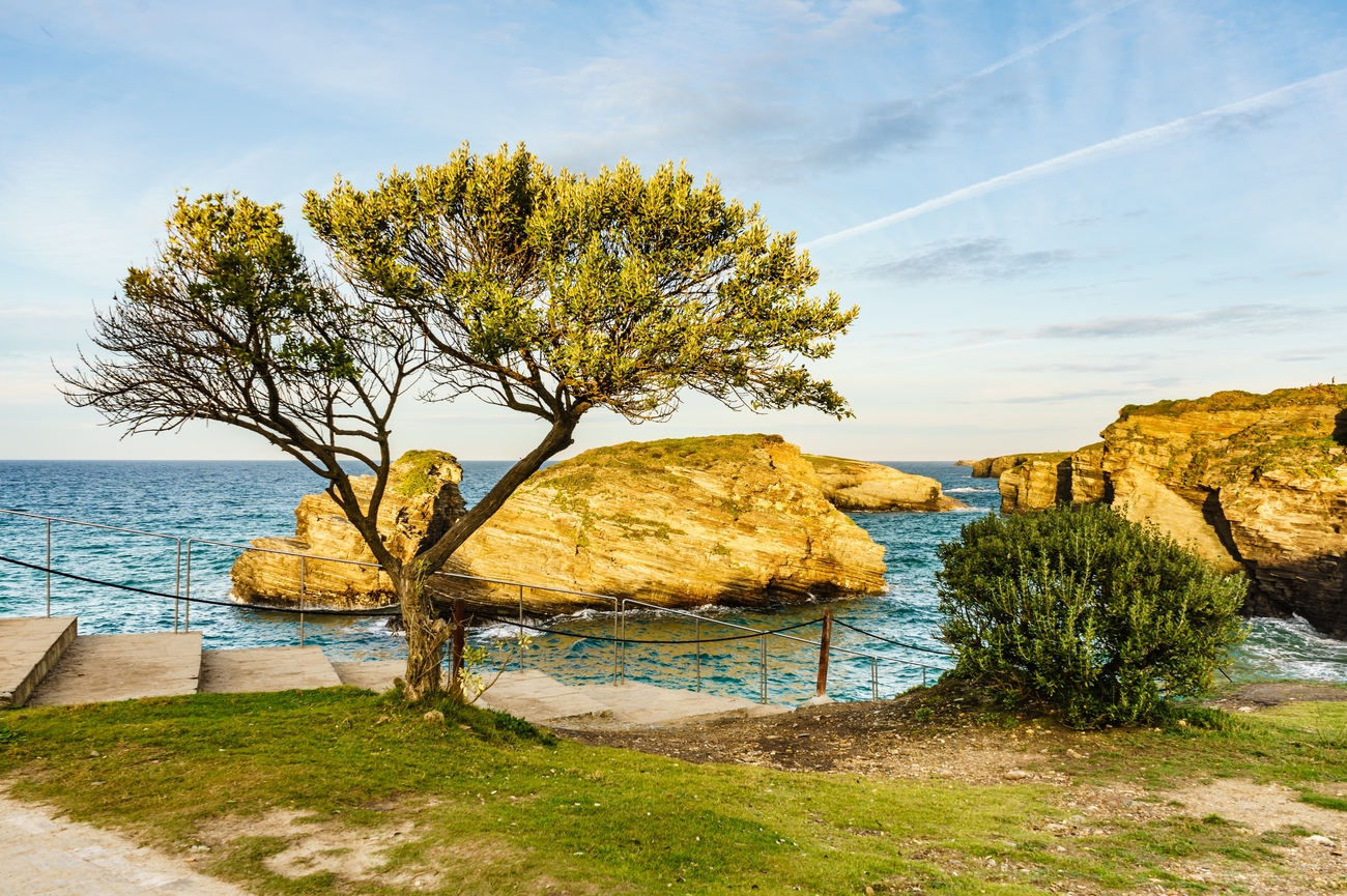
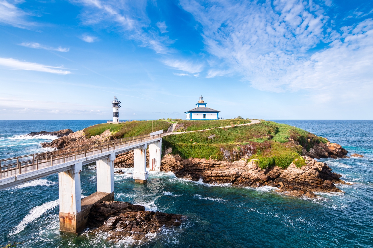
At the mouth of the estuary lies Illa Pancha, a small rocky island connected to the mainland by a short bridge. Its lighthouse has guided ships safely into the River Eo since the nineteenth century, while the former lighthouse keepers' houses have been carefully converted into distinctive seaside accommodation overlooking the Atlantic.
Closer to the town stands the Fort of San Damián, built to defend the estuary from pirates and naval attacks, and the remains of O Cargadoiro, the remarkable iron-ore loading pier that once connected Ribadeo with the mining districts inland. Extending over the water on slender iron supports, it remains one of Galicia's most recognisable industrial monuments.
For one of the finest viewpoints, climb to the Chapel of Atalaya, where the estuary, harbour and coastline spread out beneath you. From here, it becomes clear why Ribadeo developed precisely where it did: protected from the open sea yet perfectly placed for trade with both Galicia and Asturias.
None of these places demands a great deal of time. Ribadeo is best explored on foot over a relaxed afternoon before settling into one of its seafood restaurants as evening arrives.
Dinner
in Rinlo
For dinner, head west to the small fishing village of Rinlo, only a few minutes from Ribadeo.
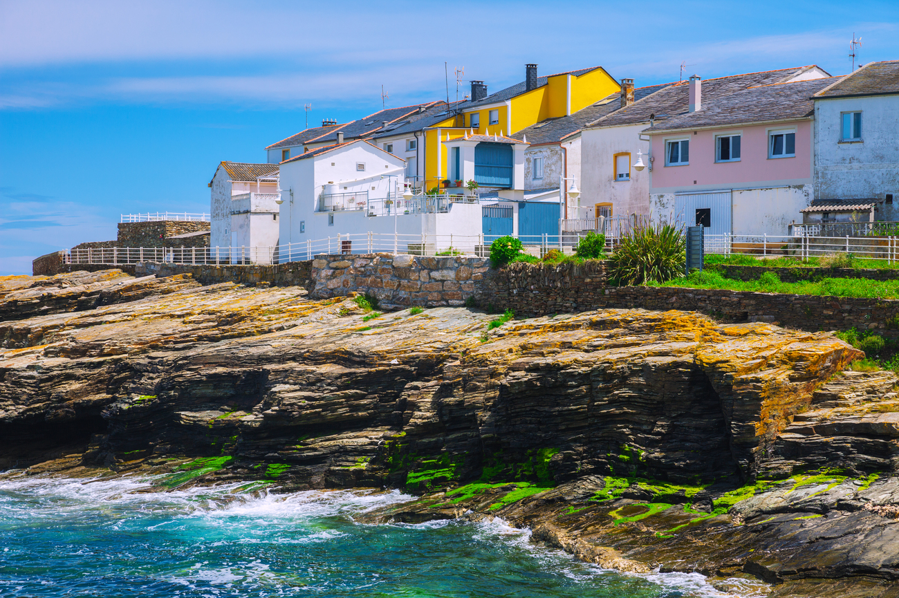
Once one of Galicia's most important whaling ports, Rinlo is now celebrated for its seafood and unhurried atmosphere. Whitewashed houses cluster around a tiny natural harbour where fishing boats still land their catch, while family-run restaurants have made the village a destination in its own right.
The local speciality is arroz con bogavante, rich rice cooked with fresh lobster, closely followed by caldereta de bogavante, the traditional Galician lobster stew. People travel considerable distances to eat these dishes in Rinlo.
Fortunately, from Ribadeo, you will not have to.
Ferrol,
Where the Narrow-Gauge Railway Ends
Ferrol is the western terminus of the narrow-gauge railway and one of Spain’s most important naval cities. Its character was shaped by the sheltered ría, the vast military Arsenal and the eighteenth-century town built around it. After days of beaches, fishing ports and green Atlantic landscapes, the journey ends in a city of shipyards, fortifications and ordered streets.
Ferrol’s naval importance began under Philip II, but the city seen today was largely created by the Spanish Bourbons during the eighteenth century. From around 1750, they transformed a small fishing settlement into a major naval base, constructing an Arsenal, shipyards, defensive works and a planned district for officers, engineers and merchants.
Much of that maritime infrastructure remains in use. Warships still enter the harbour, naval construction continues beside historic quays, and the scale of the Arsenal dominates the lower city. Ferrol is not a naval town preserved as a museum. It is a working port whose original purpose remains visible everywhere.
The
Ferrol Naval Arsenal and Exponav
The Ferrol Naval Arsenal is the city’s defining monument and the principal reason to visit. Constructed during the Enlightenment, it was designed as an integrated military port combining shipbuilding, storage, defence and naval administration.
Because the Arsenal remains an active military installation, access is restricted and guided visits must normally be arranged in advance. Inside, historic docks, defensive walls, monumental gateways and naval buildings stand alongside the infrastructure of a modern Spanish Navy base. The contrast is striking: contemporary vessels may be moored beside quays built more than two centuries ago.
One of the most impressive sections is the Cortina battery, whose long line of cannon positions defended the inner harbour. The Arsenal also contains the nineteenth-century Bell Dock and the Sala de Armas, part of the carefully planned complex created to support one of Europe’s largest naval fleets.
Beside it stands Exponav, Spain’s National Museum of Naval Construction. Housed in an eighteenth-century industrial building, the museum explains the evolution of Spanish shipbuilding through models, machinery, plans and sections of vessels. Together, the Arsenal and Exponav reveal how completely Ferrol’s history has been shaped by the sea.
On our journey, the guided visit and required arrangements are organised in advance. This allows you to enter the naval complex rather than seeing only its walls from the surrounding streets.

Barrio
de la Magdalena
Above the Arsenal lies the Barrio de la Magdalena, Ferrol’s elegant eighteenth-century centre. Designed on a geometric grid, it consists of six long parallel streets crossed by shorter roads, creating such a regular plan that locals have traditionally compared it to a bar of chocolate.
The district was built to house the officers, engineers and merchants who arrived as the naval base expanded. It became one of Spain’s earliest purpose-built urban neighbourhoods and remains a remarkably coherent example of Enlightenment town planning.
Its most distinctive architectural feature is the galería, the enclosed glass-fronted balcony that now appears throughout Galicia. Ferrol’s galleries were influenced by the glazed sterns of ships and were designed to capture sunlight while protecting interiors from wind, rain and Atlantic damp. Rows of them extend across entire façades, giving the streets their characteristic brightness and rhythm.
During the early twentieth century, architect Rodolfo Ucha added some of Ferrol’s finest Modernist buildings. His work includes richly decorated houses, commercial buildings and civic landmarks that softened the strict geometry of the original neighbourhood.
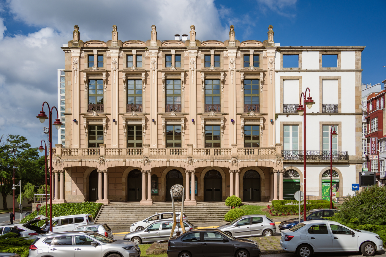
The Teatro Jofre is one of the city’s most important cultural buildings, while the nearby Casa Romero displays the curved lines, decorative ironwork and glazed surfaces associated with Ferrol’s Modernist period. At the edge of the district, the Herrera Gardens provide views directly over the Arsenal and the waters of the ría.
The lasting impression is of an entire city centre designed around naval order: straight streets, repeated façades and clear sightlines, all laid out above the working port that gave Ferrol its purpose.
Castillo
de San Felipe and the Ferrol Estuary
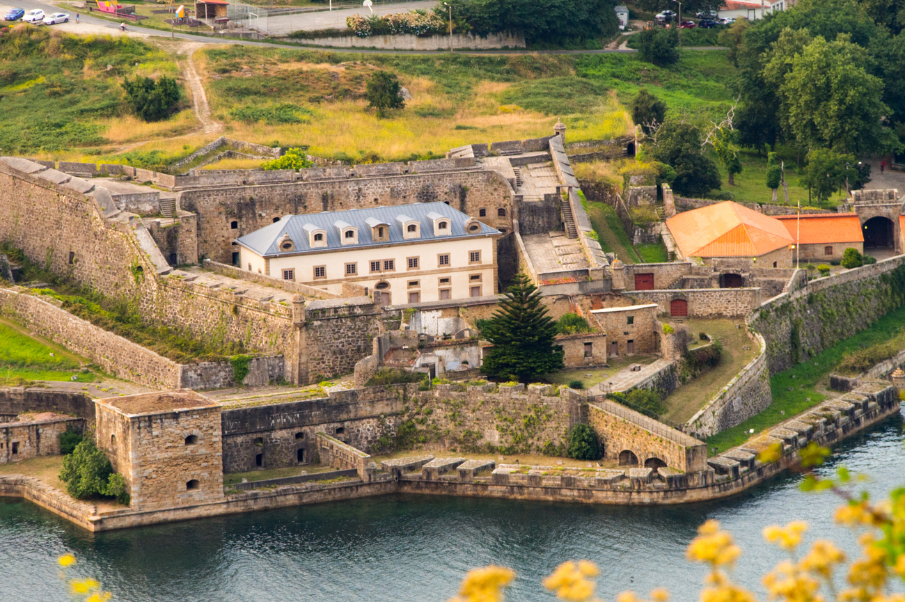
At the narrow entrance to the estuary stands the Castillo de San Felipe, the largest of the fortifications built to defend Ferrol from attack by sea. Expanded during the eighteenth century, it formed part of a defensive system with the castles of La Palma and San Martín on the opposite shore.
Together, the forts controlled the narrow channel leading towards the Arsenal. Their position allowed artillery fire to cover the entrance from several directions, making the harbour exceptionally difficult to capture.
The system proved its value in 1800, when a large British expedition attempted to seize Ferrol. Spanish forces, supported by local residents from the surrounding countryside, repelled the attack before the naval base could be taken.
Today, the castle can be explored for its stone ramparts, underground passages and wide views across the ría. The approach also reveals the scale of Ferrol’s natural harbour and explains why it became such a valuable naval base.
Canido,
Ferrol Vello and the Atlantic Coast
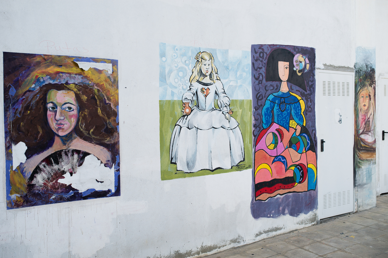
Ferrol also has a more contemporary side. In the hillside neighbourhood of Canido, local artists have transformed walls, houses and public spaces with hundreds of interpretations of Las Meninas, the figures from Velázquez’s most famous painting.
What began as a small neighbourhood initiative developed into an open-air art project involving painters from Spain and abroad. The murals range from recognisable versions of the original figures to abstract, political and humorous reinterpretations. New works are added regularly, while older paintings are repainted or allowed to fade into the streets.
Closer to the harbour, Ferrol Vello preserves the irregular lanes of the original fishing settlement that existed before the planned eighteenth-century city was constructed above it. Its narrow streets and modest houses offer a clear contrast with the ordered avenues of the Barrio de la Magdalena.
Beyond the city, the coast becomes increasingly wild. Walking routes lead towards Cabo Prior and the beaches of Doniños, where cliffs, dunes and open Atlantic water replace the enclosed calm of the ría. This outer coastline shows another side of Ferrol: exposed, windswept and facing directly towards the ocean.
What
to Eat in Ferrol
By the time the railway reaches Ferrol, the food is unmistakably Galician. Menus are built around shellfish, octopus, fish, hearty soups and pastries, accompanied by white wines from the coastal regions farther south.
Typical dishes include pulpo á feira, octopus served with olive oil, salt and paprika; caldo gallego, a warming broth traditionally prepared with greens, potatoes and beans; and Galician empanadas filled with tuna, meat, octopus or shellfish.
Ferrol also has its own traditional sweet, tarta de Ferrol, generally made with layers of pastry, chestnut cream or almonds. A slow dinner near the harbour is an appropriate way to spend the final evening of the narrow-gauge journey, with fishing boats, naval vessels and the lights of the ría beyond the windows.

From
Ferrol to Santiago de Compostela
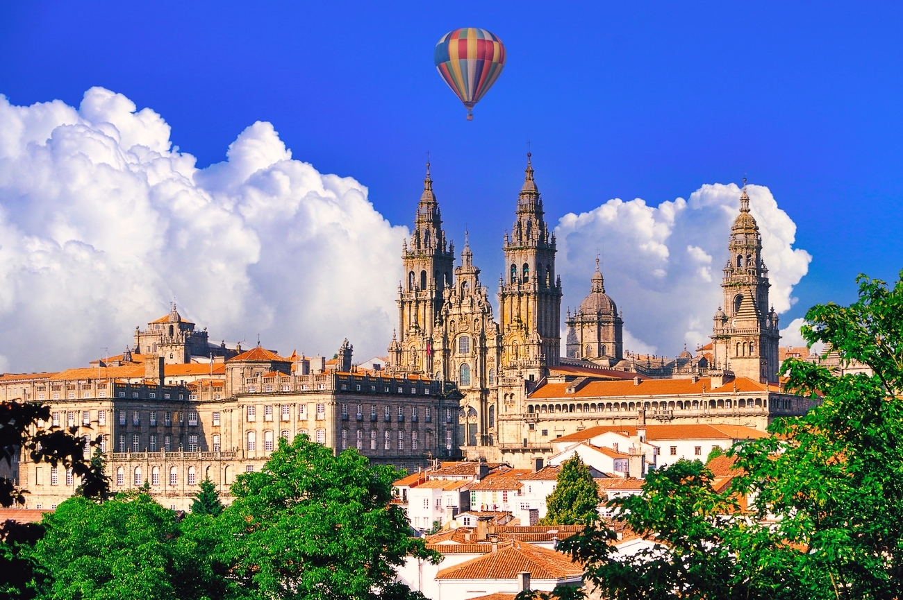
The narrow-gauge railway journey ends in Ferrol. From here, the final journey to Santiago de Compostela is made by a different rail connection or by private transfer.
Ferrol is also the traditional starting point of the Camino Inglés, the English Way to Santiago. Medieval pilgrims from Britain, Ireland, Flanders and northern Europe once arrived by sea at Galician ports before walking inland towards the cathedral.
The route from Ferrol to Santiago continues through rural Galicia, ending among the stone streets, pilgrimage traditions and celebrated restaurants of the regional capital. Santiago and the wider Galician table are explored in full in our dedicated gastronomy journey.
By the time you leave Ferrol, the narrow-gauge railway has completed its work. It has carried you from the cities and mountains of Asturias, past estuaries and Atlantic beaches, and finally to the western edge of Spain’s green northern coast.
The
End of the Narrow-Gauge Railway
There is a particular satisfaction in reaching the end of a railway line.
Ferrol is where the narrow-gauge route finally stops, at the western edge of Spain after a journey that has followed the Cantabrian coast from the Basque Country through Asturias and into Galicia. Behind you lie the fishing ports, green estuaries and mountain landscapes of the north, together with the arches revealed by the tide at Praia das Catedrais, the Indiano houses of Ribadeo and the naval city the Bourbons built around its Arsenal.
Ahead are Santiago de Compostela and the open Atlantic.
Come to Galicia to walk beneath the stone arches of Praia das Catedrais at low tide, with the required permit secured and the day arranged around the sea. Continue through Ribadeo and Ferrol without having to resolve the changing tides, rail connections and access arrangements for yourself.
Begin our Exploring Northern Spain by Narrow-Gauge Railway journey, and let us place you on the right train, at the right tide, on Spain’s far green coast.


Let us know what you love, where you want to go, and we’ll design a one-of-a-kind adventure you’ll never forget.
Get in touch
Miriam
Travel Specialist

Romina
Travel Specialist

Laura
Travel Specialist
Our offices:



Revigorate, Iberian Escapes and Algarve Lifestyle are the registered brand names of APCS Lda . We are a fully authorised travel agency licensed by Turismo de Portugal RNAVT/6867.
In the event of a dispute, the consumer may refer to: RAL - Centros de Arbitragem
Avª. 5 de Outubro, nº. 55, R/C Dtº. 8000-075 Faro, Portugal | Tel: +351 289 823 135 *
* national landline call
E-mail: info@consumoalgarve.pt| www.consumidoronline.pt | Mon to Fri: 9:00 - 13:00 / 14:00 - 17:00